Highland Park
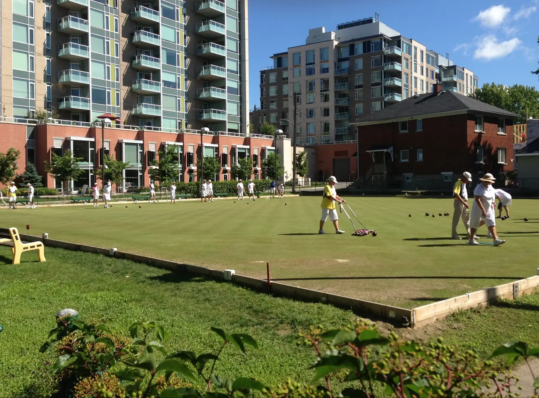
Westboro's leafy south-west quarter: early-1900s lots, two high schools, the Dovercourt pool and a lawn-bowling green dating from 1914.
* Ottawa Neighbourhood Study figures for its “Laurentian (Carlingwood, Highland Park, McKellar Park)” area, which is larger than Highland Park alone.
Highland Park is the part of Westboro between Richmond Road and Carling Avenue, from Churchill Avenue west to Denbury Avenue. From the Highland Park centre it is about 5 minutes to Broadview Public School (OCDSB, grades JK–8), 15 to Produce Depot and 14 to the future Kichi Zìbì (formerly Dominion) O-Train station (under construction, opening listed for 2027) on foot (OSRM estimates). The Ottawa Neighbourhood Study's 'Laurentian (Carlingwood, Highland Park, McKellar Park)' area had 11,420 residents in the 2021 census.
Updated · Facts on this page link to their sources
From the Highland Park centre
Walking and driving times to the nearest schools, O-Train stations and grocery stores.
| To | Nearest | Walk | Route | Drive |
|---|---|---|---|---|
| Elementary school | Broadview Public School (OCDSB, grades JK–8) | 5 min | 340 m | 3 min |
| Elementary school | Churchill Alternative School (OCDSB) | 14 min | 1.1 km | 3 min |
| Secondary school | Nepean High School (OCDSB, grades 9–12) | 5 min | 360 m | 1 min |
| Secondary school | Notre Dame High School (OCSB, grades 7–12) | 11 min | 860 m | 3 min |
| O-Train (open) | Tunney's Pasture | 43 min | 3.3 km | 6 min |
| O-Train (under construction) | Kichi Zìbì (formerly Dominion) (opening listed for 2027, provisional) | 14 min | 1.1 km | 2 min |
| Grocery store | Produce Depot | 15 min | 1.1 km | 3 min |
| Grocery store | Real Canadian Superstore | 21 min | 1.7 km | 3 min |
Estimates from OSRM on OpenStreetMap data: walking at about 5 km/h on streets and paths (no waits at crossings), driving in free-flowing traffic. Calculated 2026-10-30. Map data © OpenStreetMap contributors (ODbL).
About Highland Park
Highland Park is the part of Westboro between Richmond Road and Carling Avenue, from Churchill Avenue west to Denbury Avenue. It began in 1898, when John E. Cole subdivided part of his family's Highland View Dairy Farm into building lots, and it filled in westward until after the Second World War. Wikipedia and ONS describe it as mixed-income: larger homes nearer Richmond Road, middle-income houses, and many low-rise apartment buildings closer to Carling Avenue. Nepean and Notre Dame high schools, Westboro Kiwanis Park and the Dovercourt Recreation Centre are all inside or beside it, and the community association notes that many homes are being renovated or rebuilt.
Boundaries
Bounded by Richmond Road to the north, Carling Avenue to the south, Denbury Avenue to the west and Churchill Avenue to the east (Wikipedia; the Highland Park Ratepayers Association agrees the community extends east to Churchill, although its own association boundary stops at Golden Avenue). It is a sub-neighbourhood of Westboro, and the Westboro Community Association's area (east of Denbury) overlaps it. McKellar Park is to the west. en.wikipedia.org hpraottawa.wordpress.com
Homes
Lots were first sold from 1898, with streets west of Broadview mainly built after the Second World War. Wikipedia and ONS describe a mixed-income area: some large homes closer to Richmond Road, middle-income houses, and many lower-income low-rise apartment buildings closer to Carling Avenue. The HPRA notes a growing number of homes being renovated or demolished and rebuilt. hpraottawa.wordpress.com en.wikipedia.org
- Westboro Kiwanis Park (~0.26 km from the centre): tennis court, wading pool, playing field and outdoor rink
- Dovercourt Recreation Centre (~0.32 km): pool, fitness and programs
- Nepean High School (~0.22 km) and Broadview Public School (~0.25 km); Notre Dame High School nearby
- Highland Park Lawn Bowling Club has been here since 1914
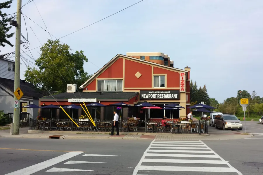
- Richmond Road shops and restaurants along the northern edge
- Byron Linear Tramway Park and the Westboro war memorial near Golden Ave
- In Kitchissippi Ward (the ward line with Bay Ward is Denbury Ave)
Community
How Highland Park came to be
- 1898
In 1898 John E. Cole, who had inherited Maplelawn and the surrounding estate, subdivided part of the Highland View Dairy Farm into building lots and advertised them in Ottawa papers; the HPRA calls this the beginning of Highland Park. hpraottawa.wordpress.com
- 1914
The Highland Park Lawn Bowling Club opened in 1914 on farmland leased from John Cole and bought the land in 1941. hpraottawa.wordpress.com
- 1916-1922
Broadway Public School (now Broadview) was built in 1916 and Nepean High School followed in 1922. hpraottawa.wordpress.com
- 1944
By 1944 Highland Park extended west to Denbury Avenue, though many lots beyond Broadview were not developed until after the war. hpraottawa.wordpress.com
- 1948
In 1948 the city took land on Cole Avenue for the park now called Westboro Kiwanis Park, and the Dovercourt Recreation Centre opened on the site in 1987. hpraottawa.wordpress.com
- 1950
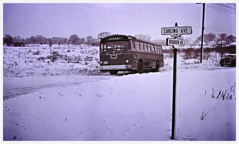
After the 1950 annexation, duplicated street names were changed: Broadway became Broadview Avenue, Main Street became Churchill Avenue, and Strathcona became Tweedsmuir Avenue. hpraottawa.wordpress.com
Local names worth knowing
- John E. Cole
Inherited Maplelawn and the surrounding estate, and in 1898 subdivided the Highland View Dairy Farm into the lots that became Highland Park. hpraottawa.wordpress.com
- Highland Park Wesleyan Church (415 Kenwood Ave)
Built in 1913 between Cole and Roosevelt; the church has carried the Highland Park name throughout its history. hpraottawa.wordpress.com
Around Highland Park
Walking rings at 5, 10 and 15 minutes from the neighbourhood centre.
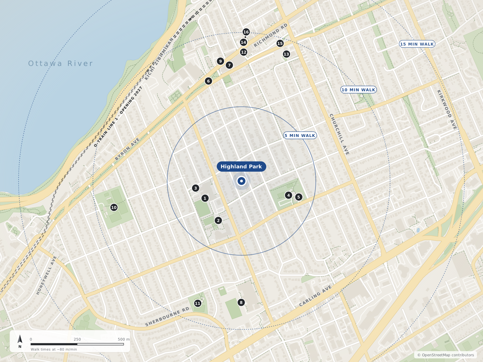
- 1Nepean HS220 m
- 2Broadview PS250 m
- 3Byron Linear Tramway Park250 m
- 4Westboro Kiwanis Park260 m
- 5Dovercourt Recreation Centre320 m
- 6Westboro Farmers' Market570 m
- 7The Clocktower Brew Pub630 m
- 8Notre Dame HS660 m
- 9The Bower Coffee Co.660 m
- 10McKellar Park700 m
- 11David Shentow Park700 m
- 12Mamie Clafoutis700 m
- 13Churchill Alternative School730 m
- 14The Barley Mow740 m
- 15Blyth Academy770 m
- 16The Piggy Market780 m
Schools
10 nearbyNepean High School
OCDSBGrades 9–12574 Broadview Avenueopenstreetmap.org nepeanhs.ocdsb.ca
220 m3 min walkBroadview Public School
OCDSBGrades JK–8590 Broadview Avenueopenstreetmap.org broadviewps.ocdsb.ca
250 m3 min walkNotre Dame High School
OCSBGrades 7–12710 Broadview Avenueopenstreetmap.org ndh.ocsb.ca ndh.ocsb.ca
660 m8 min walkChurchill Alternative School
OCDSB345 Ravenhill Avenue Eastopenstreetmap.org churchillalternative.ocdsb.ca
730 m9 min walkBlyth Academy
Independent352 Danforth Avenueopenstreetmap.org
770 m10 min walkEdelweiss Private Academy
Independent31 Nadolny Sachs Privateopenstreetmap.org
1.1 km13 min walkOttawa Jewish Community School
Independent31 Nadolny Sachs Privateopenstreetmap.org
1.2 km15 min walkRevel Academy
Independent1550 Laperriere Avenueopenstreetmap.org
1.3 km16 min walkOttawa Torah Institute
Independent1400 Coldrey Avenueopenstreetmap.org
1.5 km18 min walkOur Lady Of Fatima School
OCSBGrades JK–62135 Knightsbridge Roadopenstreetmap.org olf.ocsb.ca
1.5 km19 min walk
Straight-line distances from the Highland Park centre. Living near a school does not guarantee a place: confirm the designated school for an address with each board. All schools and board locators.
Parks & places
10 nearbyByron Linear Tramway Park
Linear City park along the former Byron streetcar corridor; it hosts the Westboro Farmers' Market on Saturdays (May 16 – Oct 31, 2026), and the underground Sherbourne and New Orchard O-Train stations are being built along its western end.
579 Byron Avenueopenstreetmap.org ottawafarmersmarket.ca en.wikipedia.org
250 m3 min walkWestboro Kiwanis Park
City park beside the Dovercourt Recreation Centre with a supervised outdoor rink in winter and the Westboro wading pool in summer (per OSM/City data).
411 Dovercourt Avenueopenstreetmap.org openstreetmap.org openstreetmap.org
260 m3 min walkDovercourt Recreation Centre
City recreation centre run with the Dovercourt Recreation Association: indoor pool with swim lessons and drop-in swims, fitness centre, pickleball, afterschool program, camps and a café; the Westboro wading pool, Westboro Kiwanis Park rink and a skateboard park are on the same site.
411 Dovercourt Avenueopenstreetmap.org dovercourt.org openstreetmap.org
320 m4 min walkMcKellar Park
City park with the McKellar Park Fieldhouse (programs run by the Dovercourt Recreation Association), a supervised double-surface outdoor rink and a wading pool.
539 Wavell Avenueopenstreetmap.org openstreetmap.org openstreetmap.org
700 m9 min walkDavid Shentow Park
City park on Tillbury Avenue West (leashed dogs per OSM).
590 Tillbury Avenue Westopenstreetmap.org
700 m9 min walkOttawa River Pathway (Trans Canada Trail)
Multi-use cycling and walking pathway along the Ottawa River, part of the NCC's Capital Pathway network (200+ km of off-road pathways) and mapped in OSM as part of the Trans Canada Trail.
openstreetmap.org ncc-ccn.gc.ca openstreetmap.org
750 m9 min walkClare Gardens Park
Small City park on Clare Street in Westboro (no dogs per OSM).
269 Clare Streetopenstreetmap.org
800 m10 min walkChurchill Seniors Recreation Centre
City of Ottawa seniors' recreation centre on Richmond Road in Westboro.
345 Richmond Roadopenstreetmap.org
900 m11 min walkWestwood Park
City of Ottawa neighbourhood park on Saville Row (dogs allowed per OSM).
2000 Saville Rowopenstreetmap.org
1.1 km14 min walkLion's Park
City park on Elmgrove Avenue beside the Ottawa Gymnastics Centre, with the Lions summer wading pool.
294 Elmgrove Avenueopenstreetmap.org openstreetmap.org ottawa.ca
1.2 km15 min walk
Shops & dining
10 nearbyWestboro Farmers' Market
Ottawa Farmers' Market's Westboro location: 60+ local vendors in Byron Linear Park every Saturday, May 16 – Oct 31, 2026, 9 am – 3 pm.
openstreetmap.org ottawafarmersmarket.ca
570 m7 min walkThe Clocktower Brew Pub
Brew pub on Richmond Road, a Westboro Village BIA member.
418 Richmond Roadopenstreetmap.org westborovillage.com
630 m8 min walkThe Bower Coffee Co.
Coffee shop, a Westboro Village BIA member.
429 Richmond Roadopenstreetmap.org westborovillage.com
660 m8 min walkMamie Clafoutis
Pastry shop at Richmond Road and Roosevelt Avenue, a Westboro Village BIA member.
411 Roosevelt Avenueopenstreetmap.org westborovillage.com
700 m9 min walkThe Barley Mow
Pub on Richmond Road, a Westboro Village BIA member.
399 Richmond Roadopenstreetmap.org westborovillage.com
740 m9 min walkThe Piggy Market
Butcher shop on Winston Avenue, a Westboro Village BIA member.
400 Winston Avenueopenstreetmap.org westborovillage.com
780 m10 min walkThyme & Again Kitchen & Food Shop
Kitchen and prepared-food shop on Carling Avenue.
1845 Carling Avenueopenstreetmap.org
780 m10 min walkMEC Mountain Equipment Company
MEC outdoor gear store, a Westboro Village BIA member.
366 Richmond Roadopenstreetmap.org westborovillage.com
790 m10 min walkFjällräven
Fjällräven outdoor clothing store, a Westboro Village BIA member.
373 Richmond Roadopenstreetmap.org westborovillage.com
800 m10 min walkProduce Depot
Greengrocer (produce store) on Carling Avenue.
1855 Carling Avenueopenstreetmap.org
820 m10 min walk
Getting around
TransitOttawa River Pathway (active transportation)
Off-road NCC multi-use pathway along the river, part of the 200+ km Capital Pathway network — a car-free cycling/walking route east toward downtown and west along the river.
openopenstreetmap.org ncc-ccn.gc.ca
750 m9 min walkRichmond Road bus corridor
Westboro Village's main street; OSM bus route relations on Richmond Road in the area include routes 11, 51, 81 and 153. Route numbers change — confirm on octranspo.com.
openopenstreetmap.org overpass-api.de
880 m11 min walkKichi Zìbì (formerly Dominion)
Future trench-level O-Train station replacing Dominion Transitway station by the Kichi Zībī Mīkan, about 225 m from Richmond Road and close to Westboro Beach. OC Transpo reported its elevators installed in 2025. Not open as of Oct 2026. OC Transpo (Mar 12, 2026) expected handover to the City in Q2 2027 and passenger service in Q3 2027; Canada Day 2026 flooding damaged parts of the extension between New Orchard and Moodie and OC Transpo has said it may open the extension in parts (CTV, Aug 5, 2026).
under constructionopenstreetmap.org en.wikipedia.org octranspo.com
950 m12 min walkHighway 417 (Queensway) access
The Queensway runs along the south side of the area; OSM maps motorway junctions numbered 124 and 126 within the study area (exit names not verified here).
openopenstreetmap.org openstreetmap.org overpass-api.de
1.1 km14 min walkFuture O-Train
Kichi Zìbì station (~0.95 km), Sherbourne station (~1.17 km) and Westboro station (~1.42 km) on the Line 1 west extension, listed for 2027.
O-Train timing caveat
CTV reported the west extension launch delayed to summer 2027 (Mar 12, 2026) and that Canada Day 2026 flood damage could mean a partial opening (Aug 5, 2026).
Bus (OC Transpo)
Frequent routes 11 and 16 on Richmond Road (Wikipedia); Carling Avenue is also a bus corridor. Confirm current routes on octranspo.com.
For sale in Highland Park
No Highland Park homes on westboro.homes right now
Selling here? Get a website for your home, or browse every home for sale in the area.
Neighbouring areas
Quick answers
Short answers first; each links to the full answer and its sources.
Which high schools are near Westboro?
Nepean High School (574 Broadview Avenue, OCDSB, grades 9–12) and Notre Dame High School (710 Broadview Avenue, Ottawa Catholic School Board, grades 7–12) are both in Highland Park. Woodroffe High School (2410 Georgina Drive, OCDSB, grades 9–12) is south-west of the area.
As of 2026-10-30 · nepeanhs.ocdsb.ca ndh.ocsb.ca
What parks are in Westboro?
Parks in and around Westboro include Westboro Kiwanis Park beside the Dovercourt Recreation Centre (outdoor rink and wading pool), Lion's Park (wading pool), Clare Gardens Park and the Byron Linear Tramway Park on the old streetcar line. The Ottawa River Pathway and Westboro Beach run along the area's northern edge.
As of 2026-10-30 · openstreetmap.org openstreetmap.org
Is Westboro a good place for retirees?
Westboro has the City's Churchill Seniors Recreation Centre at 345 Richmond Road, and from the neighbourhood centre two grocery stores are an 8- to 10-minute walk, with several pharmacies on Richmond Road. The Highland Park Lawn Bowling Club, open since 1914, is nearby.
As of 2026-10-30 · westboro.homes openstreetmap.org
Where is Highland Park in Ottawa?
Highland Park is the south-west quarter of Westboro, between Richmond Road and Carling Avenue, from Churchill Avenue west to Denbury Avenue. McKellar Park is directly to the west.
As of 2026-10-30 · en.wikipedia.org hpraottawa.wordpress.com
Is Highland Park in Ottawa good for families?
Highland Park has Broadview Public School (JK–8) and Nepean High School (9–12) each about a 5-minute walk from its centre, and Notre Dame High School (7–12) about 11 minutes away. Westboro Kiwanis Park, with a rink and wading pool, and the Dovercourt Recreation Centre's indoor pool are in the neighbourhood.
As of 2026-10-30 · westboro.homes openstreetmap.org
What schools are closest to Highland Park, Ottawa?
From the Highland Park centre, Broadview Public School (OCDSB, JK–8) and Nepean High School (OCDSB, grades 9–12) are each about a 5-minute walk, and Notre Dame High School (OCSB, grades 7–12) about 11 minutes. Churchill Alternative School is about 14 minutes away.
As of 2026-10-30 · westboro.homes openstreetmap.org